Property Record
730 W James Ave, Rossville, GA 30741
NEARBY LISTINGS FOR SALE OR LEASE
-
-
View all Rossville listings for sale on LoopNet.com
Property Detail
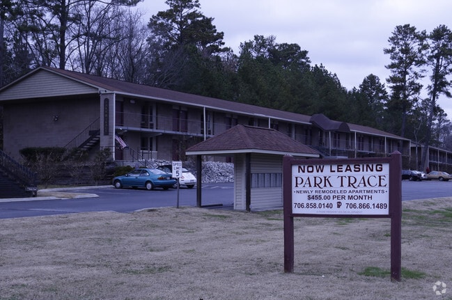
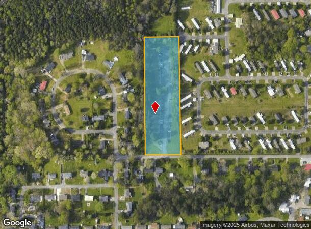
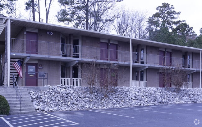
730 W James Ave
0116-015B
Battlebluff
Commercialnec
PTLL 31 9/4
X
Walker
47065C0452G
Georgia
2024
3.44 AC
2024
Rossville
020301
Chattanooga
21,056 SF
Chattanooga, TN-GA
DEMOGRAPHICS near 730 W James Ave
1 Mile
3 Mile
5 Mile
2024 Total Population
4,036
35,840
94,244
2029 Population
4,212
37,817
99,639
Pop Growth 2024-2029
+ 4.36%
+ 5.52%
+ 5.72%
Average Age
39
39
39
2024 Total Households
1,583
13,784
37,937
HH Growth 2024-2029
+ 4.42%
+ 5.57%
+ 5.86%
Median Household Inc
$33,732
$41,110
$45,212
Avg Household Size
2.50
2.50
2.40
2024 Avg HH Vehicles
2.00
2.00
2.00
Median Home Value
$96,401
$154,430
$167,997
Median Year Built
1972
1959
1964
Nearby Places
Map Layers
Map Styles
 Street
 Aerial
- Restaurants
- Banks
- Shops
- Fitness
- Groceries
PUBLIC TRANSPORTATION
AIRPORT
Lovell Field
DRIVE
WALK
Distance
Lovell Field
24 min
12.2 mi
Freight Ports
Georgia Ports - Savannah
DRIVE
WALK
Distance
Georgia Ports - Savannah
408 min
362.8 mi
Nearby Properties
Address
Land Use
TOTAL SIZE
Lot Size
Zoning
Address
Land Use
TOTAL SIZE
Lot Size
Zoning
296,016 SF
13.36 AC
R3
Address
Land Use
TOTAL SIZE
Lot Size
Zoning
1.61 AC
R2
Address
Land Use
TOTAL SIZE
Lot Size
Zoning
184,050 SF
43.42 AC
C1
Address
Land Use
TOTAL SIZE
Lot Size
Zoning
458,265 SF
62.80 AC
M1
Address
Land Use
TOTAL SIZE
Lot Size
Zoning
32,472 SF
17.50 AC
C1
Address
Land Use
TOTAL SIZE
Lot Size
Zoning
15,344 SF
13.14 AC
R3
Address
Land Use
TOTAL SIZE
Lot Size
Zoning
65,884 SF
2.40 AC
Address
Land Use
TOTAL SIZE
Lot Size
Zoning
111,056 SF
9.89 AC
R4
Address
Land Use
TOTAL SIZE
Lot Size
Zoning
86,582 SF
10.26 AC
M1
Address
Land Use
TOTAL SIZE
Lot Size
Zoning
10.50 AC
Address
Land Use
TOTAL SIZE
Lot Size
Zoning
152,488 SF
6 AC
M1
Address
Land Use
TOTAL SIZE
Lot Size
Zoning
298,470 SF
15.03 AC
M1
Address
Land Use
TOTAL SIZE
Lot Size
Zoning
296,859 SF
10.42 AC
M1
Address
Land Use
TOTAL SIZE
Lot Size
Zoning
61,370 SF
10.16 AC
I
Address
Land Use
TOTAL SIZE
Lot Size
Zoning
242,000 SF
12.05 AC
M1
Address
Land Use
TOTAL SIZE
Lot Size
Zoning
4.80 AC
R2
Address
Land Use
TOTAL SIZE
Lot Size
Zoning
59,496 SF
4.77 AC
M1
Address
Land Use
TOTAL SIZE
Lot Size
Zoning
16,790 SF
1.15 AC
R2
Address
Land Use
TOTAL SIZE
Lot Size
Zoning
65,455 SF
11.25 AC
R3
Address
Land Use
TOTAL SIZE
Lot Size
Zoning
656 SF
7.14 AC
R4
Address
Land Use
TOTAL SIZE
Lot Size
Zoning
9,642 SF
0.38 AC
Address
Land Use
TOTAL SIZE
Lot Size
Zoning
174,965 SF
7.20 AC
Address
Land Use
TOTAL SIZE
Lot Size
Zoning
Address
Land Use
TOTAL SIZE
Lot Size
Zoning
38,575 SF
9.07 AC
M1
Address
Land Use
TOTAL SIZE
Lot Size
Zoning
146,834 SF
7.38 AC
M1
Address
Land Use
TOTAL SIZE
Lot Size
Zoning
14,457 SF
2.06 AC
C2
Address
Land Use
TOTAL SIZE
Lot Size
Zoning
Address
Land Use
TOTAL SIZE
Lot Size
Zoning
20,739 SF
5.30 AC
R3
Address
Land Use
TOTAL SIZE
Lot Size
Zoning
3.80 AC
R2
Address
Land Use
TOTAL SIZE
Lot Size
Zoning
27,664 SF
252.56 AC
I
The World's #1 Commercial Real Estate Marketplace
Connect with us
© 2026 CoStar Group
The information above has been obtained from sources believed reliable. While we do not doubt its accuracy we have not verified it and make no guarantee, warranty or representation about it. It is your responsibility to independently confirm its accuracy and completeness. Any projections, opinions, assumptions, or estimates used are for example only and do not represent the current or future performance of the property. The value of this transaction to you depends on tax and other factors which should be evaluated by your tax, financial, and legal advisors. You and your advisors should conduct a careful, independent investigation of the property to determine to your satisfaction the suitability of the property for your needs.